
1931年-象形中华民国人物与地全图
Map of China. Compiled by John A. Diakoff
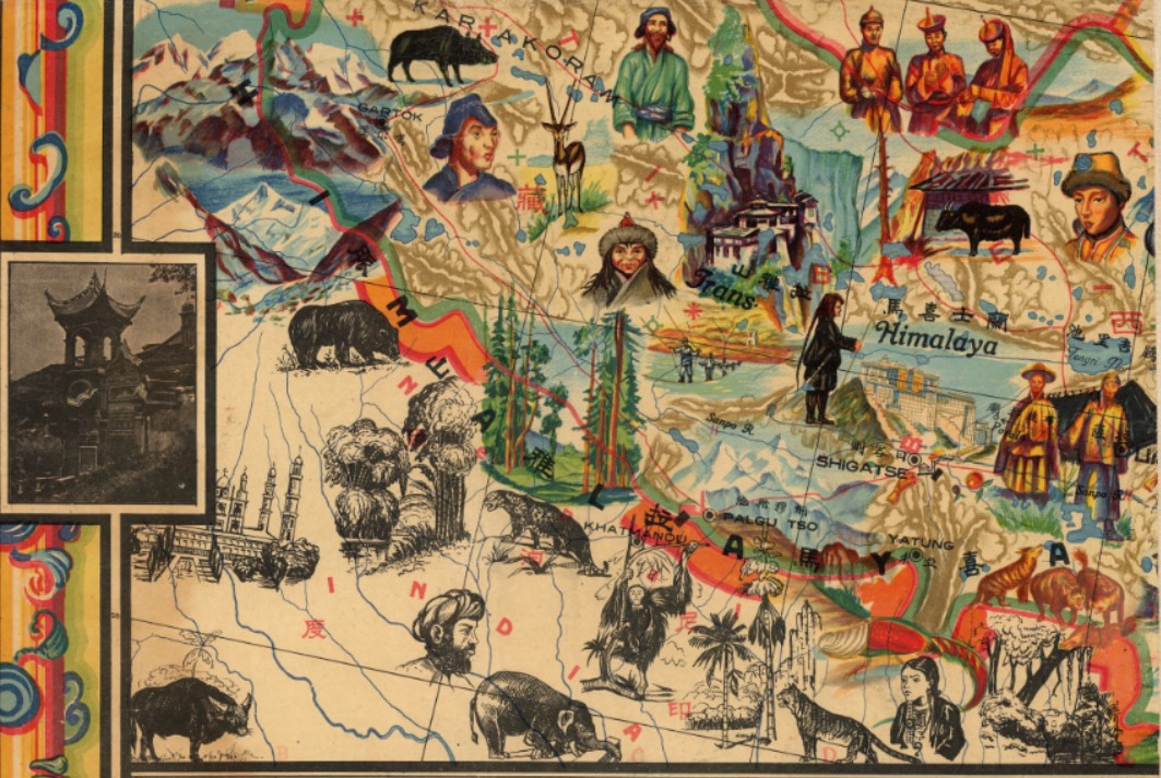
旧时代风俗地理插画老地图参考素材

Color pictorial map of China in Chinese and English, 138×180, on sheet 152×201, dissected into 16 section 38.5×49.5 and mounted on linen. Illustrated by G. Primakoff to show the extraordinary diversity in China. Insets of January and July isotherms across the Asian landmass help explain the diversity of the country, depicted natural and man-made resources, political and administrative boundaries, provinces, cities, capitals, roads, railroads, wildlife, mountains, rivers, lakes, canals, landmarks, agricultural districts, religious and educational buildings, etc. Includes vignettes of scenery and landmarks around the border. Relief shown pictorially.


- 文件格式: jpg
- 文件数量: 1p
- 文件体积: 91.1MB
- 分辨率: 20021*15386
下载地址:


![《少女革命.-.CHIHO.SAITO》[齊籐千惠]](http://www.digdart.com/wp-content/uploads/2021/09/00luxury0-150x150.jpg "《少女革命 – CHIHO.SAITO》[齊籐千惠]")
")
![《天野喜孝美女画集.-.処女宮》(Yoshitaka.Amano.-.The.Virgin)[DPG][C0EAFF55][天野喜孝]](http://www.digdart.com/wp-content/uploads/2021/08/000-150x150.jpg "《天野喜孝美女画集 – 処女宮》(Yoshitaka Amano – The Virgin)[DPG][C0EAFF55][天野喜孝]")
![北条司[美女写真馆]封面](http://www.digdart.com/wp-content/uploads/2021/03/001-1-150x150.jpg "北条司美女写真馆")
Thanks!